Access to resources for practitioners in their battle against invasive species.
In addition, production losses and higher production costs arising from the disaster across all sectors (referred to as losses) are estimated at SAT 229.4 million, or US$100.6 million. Thus the total effects of the disaster amount to SAT 465 million, or US$203.9 million.
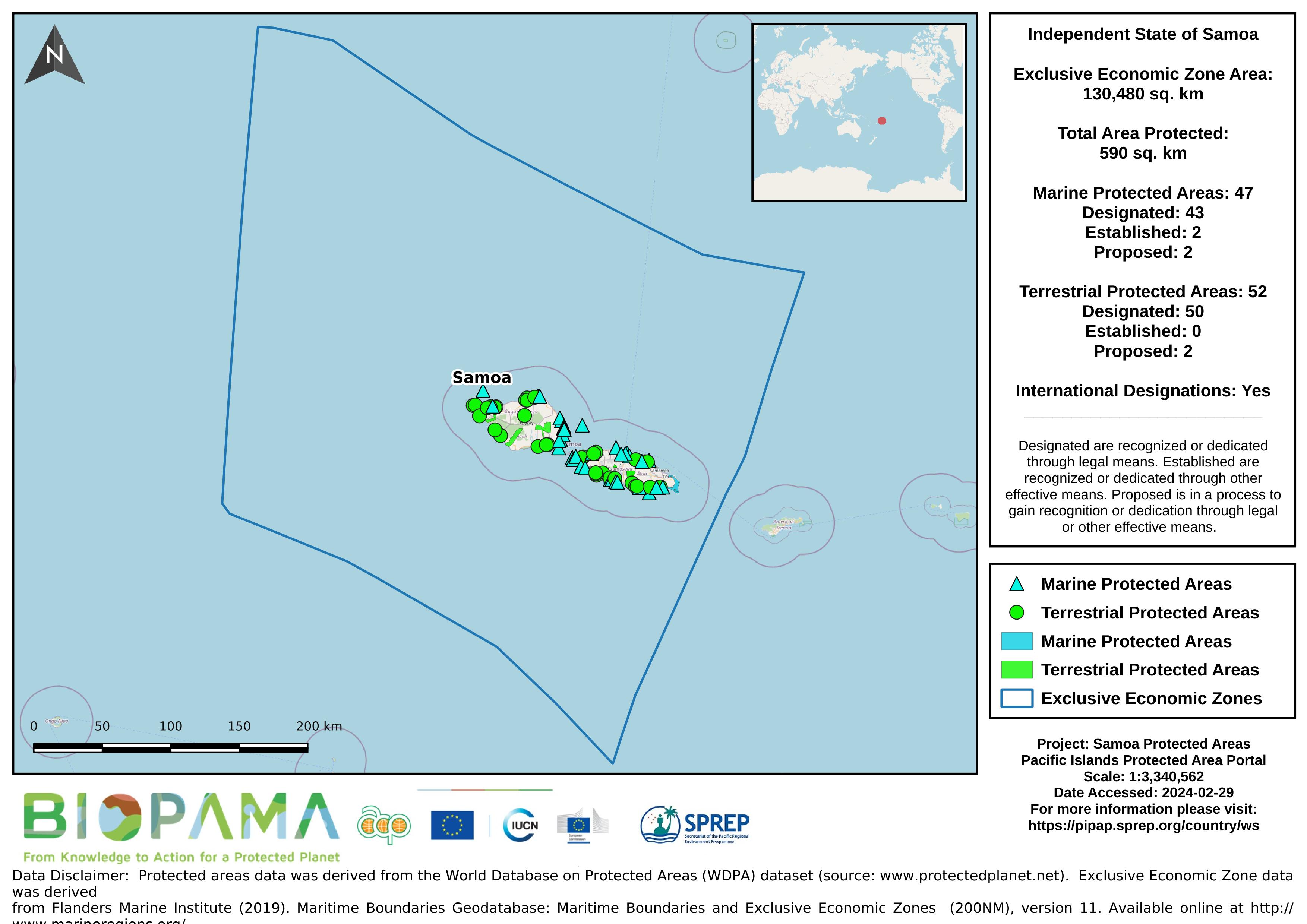
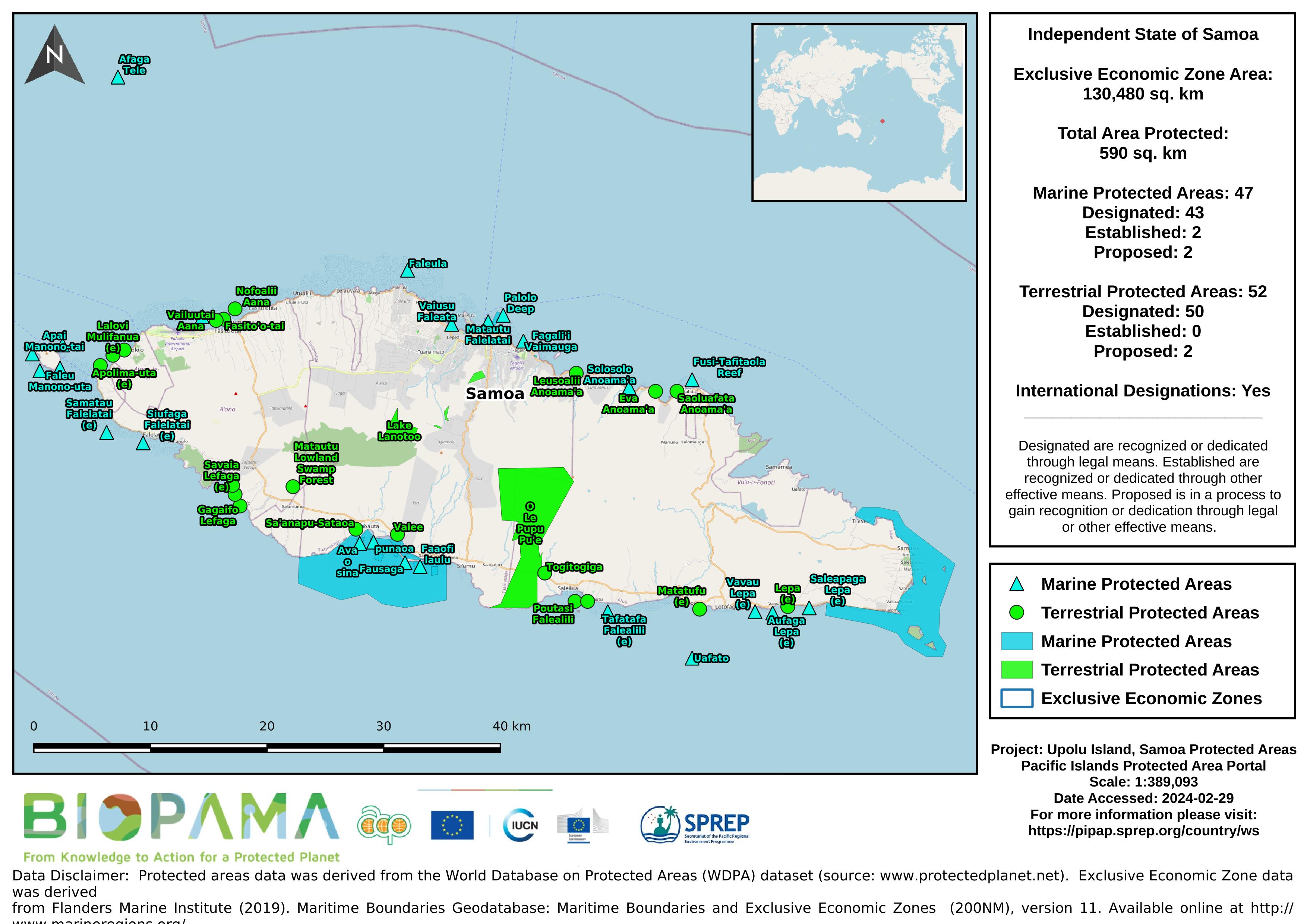
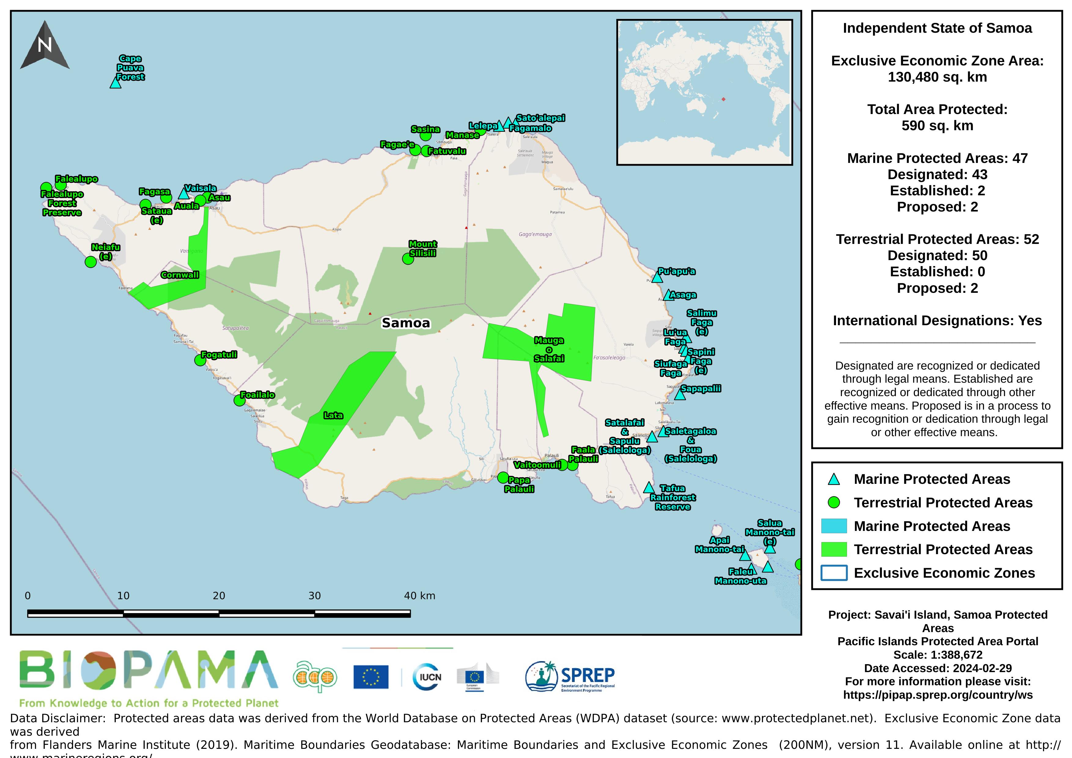
The Protected Areas Working Group (PAWG) of the Pacific Islands Round Table for Nature Conservation recommended a forum to better connect a diverse range of people and their work relating to protected and conserved areas. To increase efficacy with respect to gaining momentum with communications and conservation work, the Pacific Islands Protected Area Portal (PIPAP) was launched.
Most atoll ecosystems and a wide range of terrestrial and marine organisms, and genetic or cultivars varieties of
traditional food and other multi-purpose plants are declining in abundance and under threat of either “economic extinction” or extirpation and in need of some form of protection. The severity of the situation is greatest on those more urbanized atolls where both the biodiversity and the local knowledge of biodiversity are threatened.
*see R Thanman pdf report for more information*