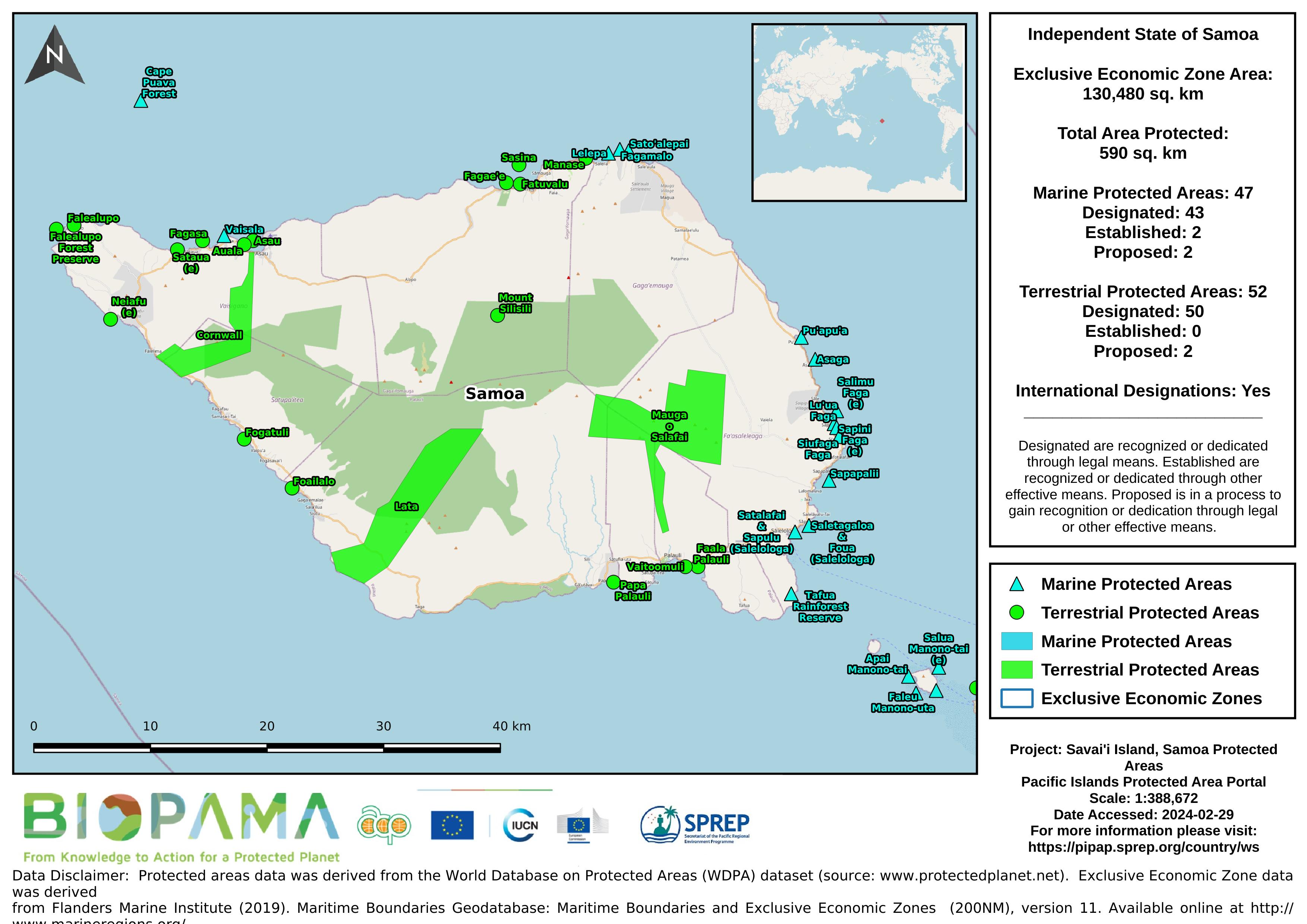
Map of the protected areas for Savai'i in Samoa with country-level summary statistics on the amount of area under protection, count for each type of protected area (terrestrial or marine), and the count of their designation.
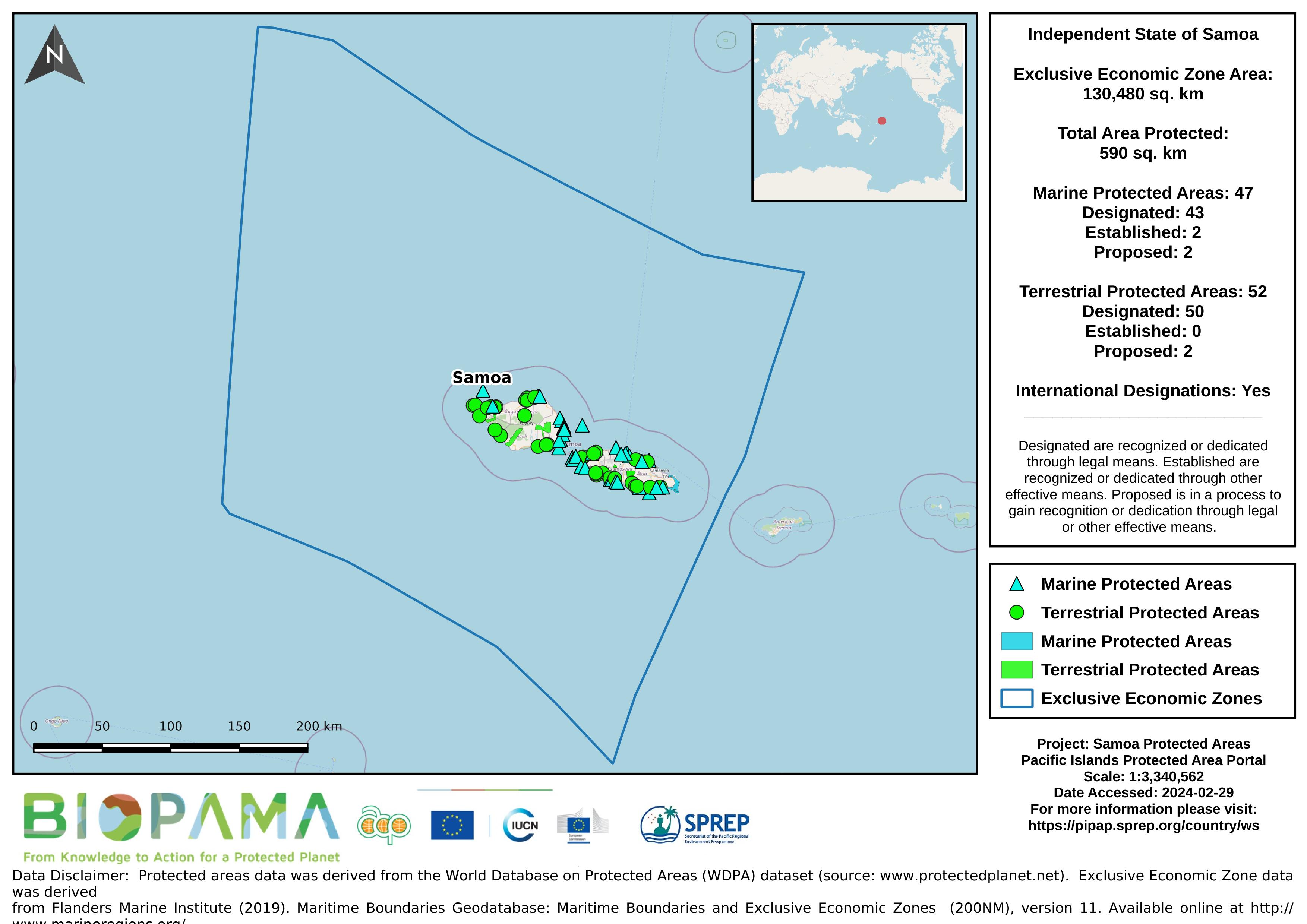
Map of the protected areas for Samoa with country-level summary statistics on the amount of area under protection, count for each type of protected area (terrestrial or marine), and the count of their designation.
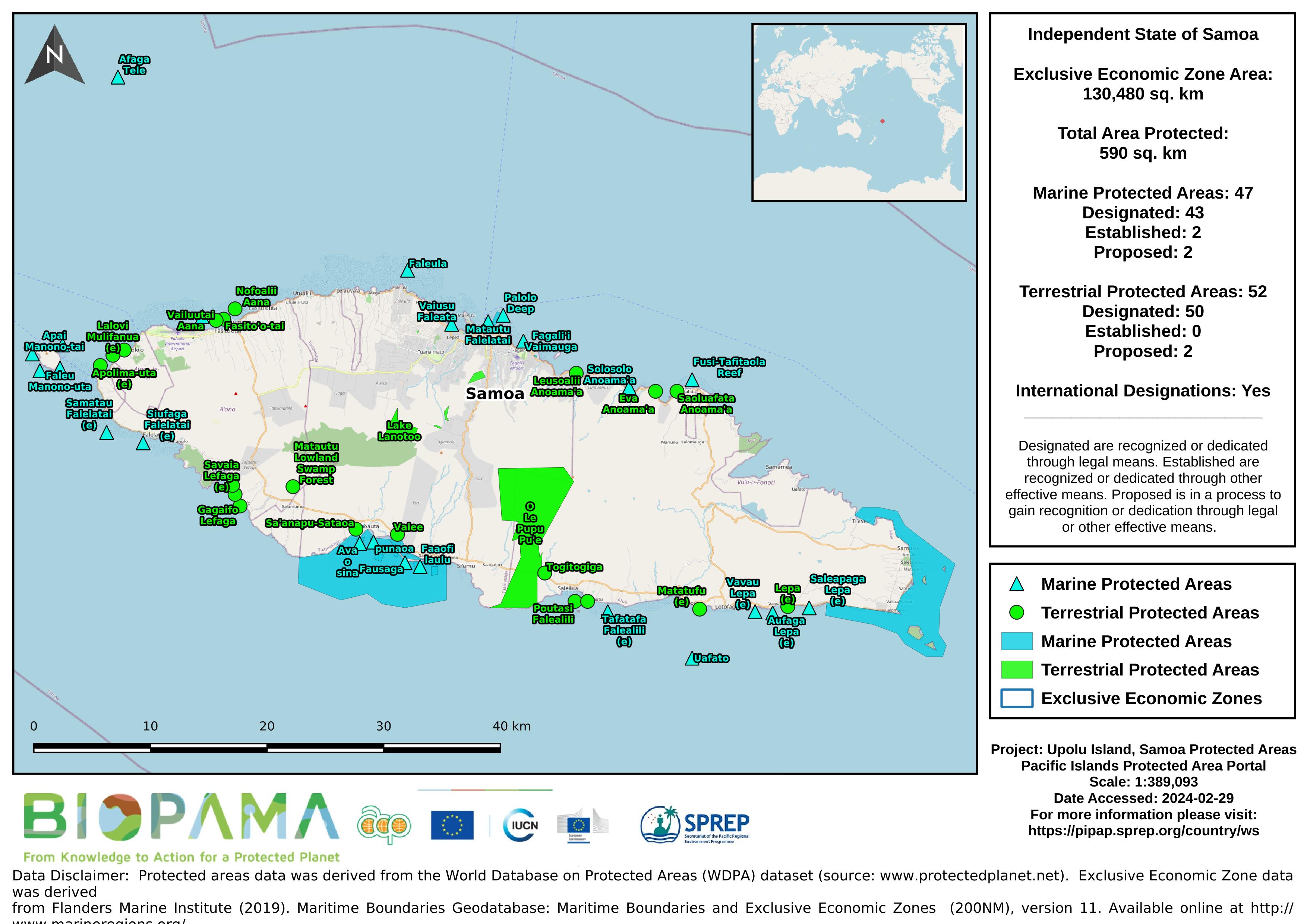
Map of the protected areas for Upolu in Samoa with country-level summary statistics on the amount of area under protection, count for each type of protected area (terrestrial or marine), and the count of their designation.
Lecture on the country-specific data and QGIS overview.
Lecture on the fundamentals of GPS devices and systems and how to set coordinate systems.
GIS datasets that are used in the exercises for the PIPAP GIS training.
Workbook containing exercises on viewing data, creating/editing datasets, producing maps, and importing GPS data using country-specific datasets to aid in the collection and mapping of protected areas.
For the Ninth Pacific Islands Conference on Nature Conservation and Protected Areas December 2013, Secretariat of the Pacific Regional Environment Programme (SPREP) commissioned an assessment of the status of biodiversity and conservation in Oceania. This report assesses the overall state of conservation in Samoa using 16 indicators.
*this report wasn't published but was sent to country for checking (2013) *- to be used for the Regional SOE initiative 2019