Link to download a zip file containing OSM spatial files, a QGIS project, styles, license file and documentation on how to get started.
This dataset contains mapped point locations for protected areas within Samoa. This dataset should be viewed in combination with the World Database on Protected Areas polygon locations to get a comprehensive view of all protected areas within Samoa.
This dataset contains mapped point locations for protected areas within Samoa. This dataset should be viewed in combination with the World Database on Protected Areas polygon locations to get a comprehensive view of all protected areas within Samoa.
This dataset contains mapped polygon locations for protected areas within Samoa. This dataset should be viewed in combination with the World Database on Protected Areas point locations to get a comprehensive view of all protected areas within Samoa.
This dataset contains mapped polygon locations for protected areas within Samoa. This dataset should be viewed in combination with the World Database on Protected Areas point locations to get a comprehensive view of all protected areas within Samoa.
The WDPA User Manual provides information and guidance about the data held within the WDPA, including its history, how it is collected, managed and distributed, and how it should be interpreted and used for analyses and research. The Manual has been prepared for WDPA data providers and users. It is structured in 4 sections and includes 6 appendices.
The Protected Areas Working Group (PAWG) of the Pacific Islands Round Table for Nature Conservation recommended a forum to better connect a diverse range of people and their work relating to protected and conserved areas. To increase efficacy with respect to gaining momentum with communications and conservation work, the Pacific Islands Protected Area Portal (PIPAP) was launched.
Resource contains raster files for a Digital Elevation Model (DEM) and derived hillshade for Samoa.
The ASTER Global Digital Elevation Model (GDEM) Version 3 (ASTGTM) provides a global digital elevation model (DEM) of land areas on Earth at a spatial resolution of 1 arc second (approximately 30 meter horizontal posting at the equator).
This resource contains satellite imagery for the Independent State of Samoa. The imagery was collected on March 11, 2018, August 8, 2018, October 12, 2019, and June 18, 2020.
More specially, this resource contains a raster file of RGB imagery at 10-meter resolution, using Level-2A products when available. Level-2A products include atmospheric correction and represent bottom of atmosphere reflectance values in the images. When Level-2A products were not available, Level-1C (top of atmosphere) products were used.
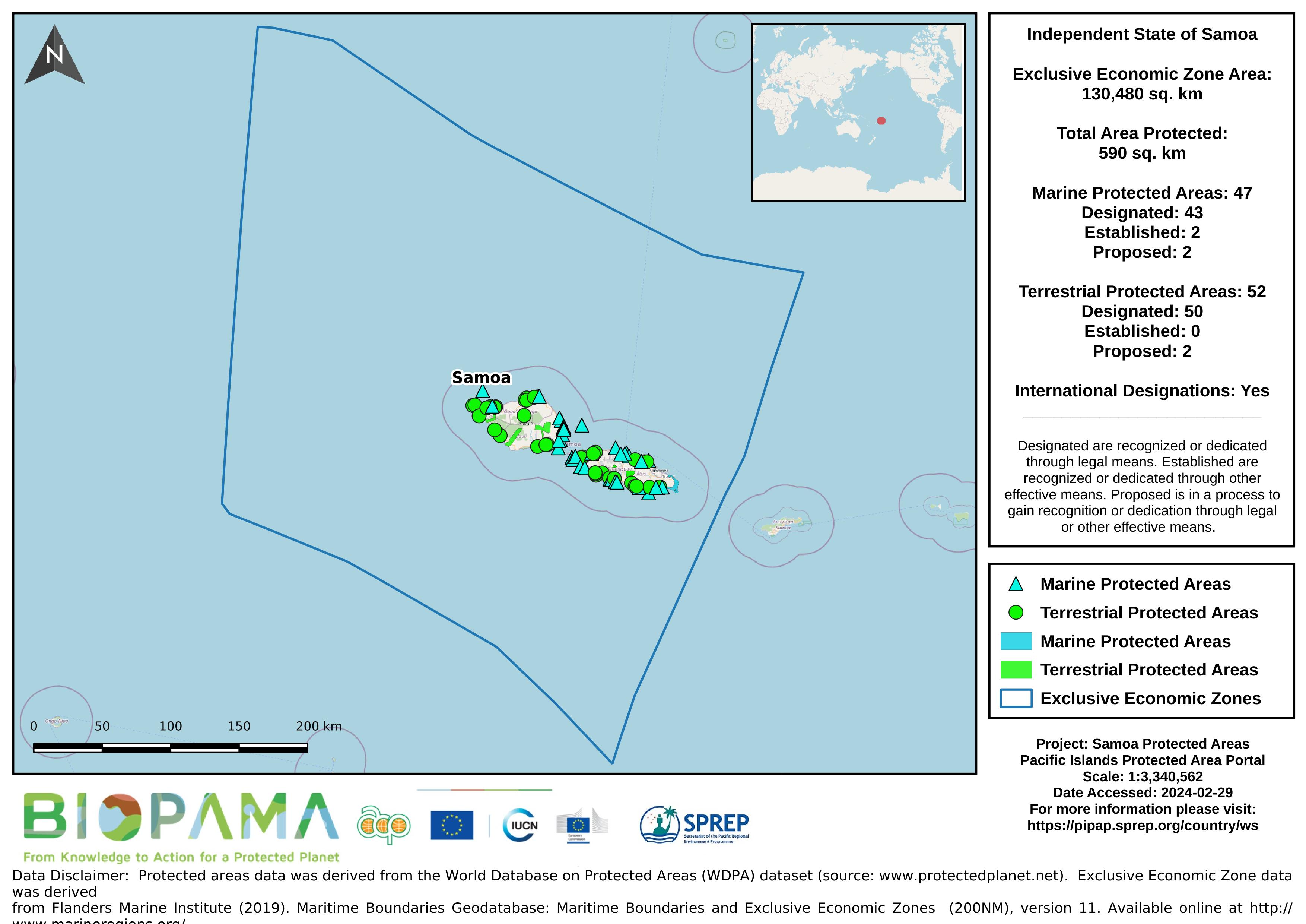
Map of the protected areas for Samoa with country-level summary statistics on the amount of area under protection, count for each type of protected area (terrestrial or marine), and the count of their designation.
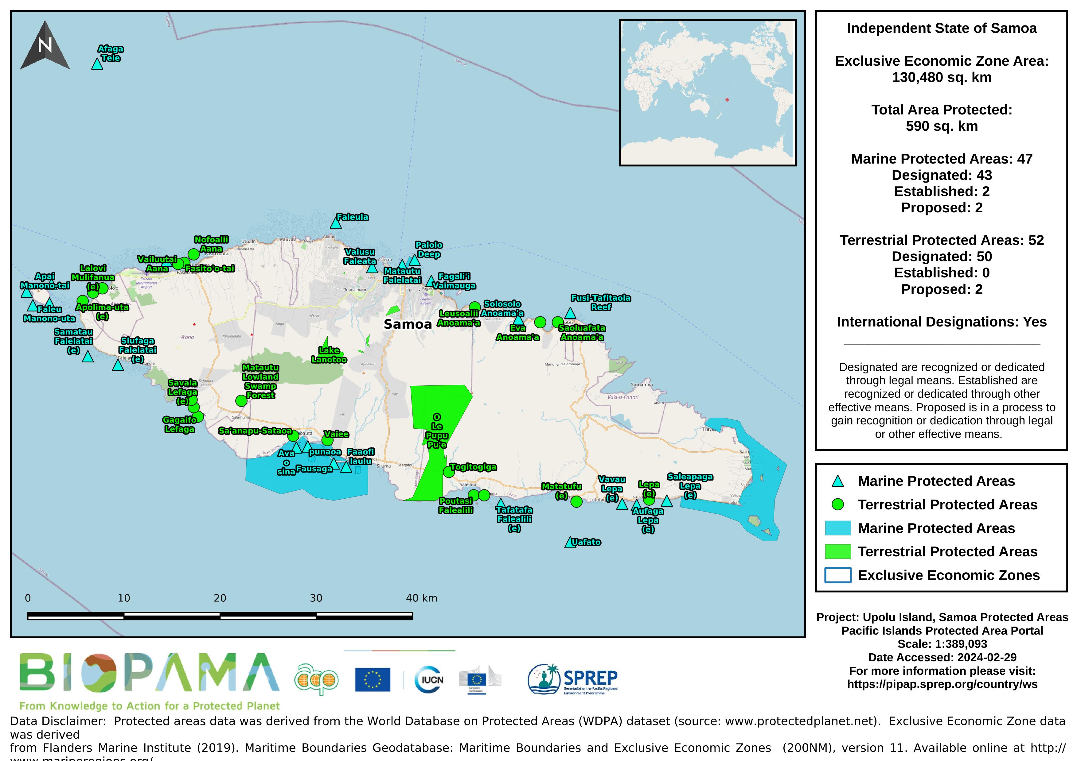
Map of the protected areas for Upolu in Samoa with country-level summary statistics on the amount of area under protection, count for each type of protected area (terrestrial or marine), and the count of their designation.
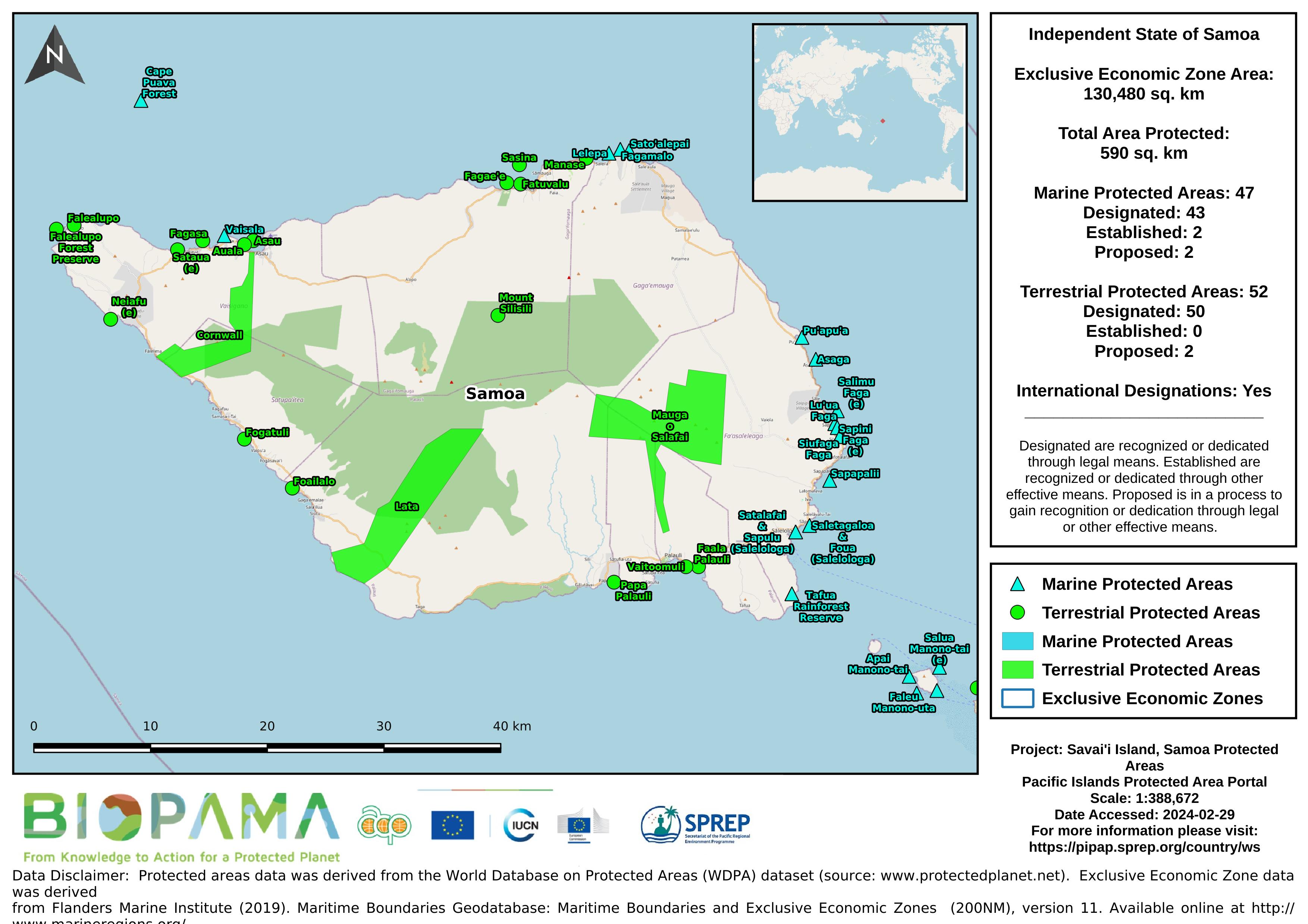
Map of the protected areas for Savai'i in Samoa with country-level summary statistics on the amount of area under protection, count for each type of protected area (terrestrial or marine), and the count of their designation.
Map of the protected areas for Samoa with country-level summary statistics on the amount of area under protection, count for each type of protected area (terrestrial or marine), and the count of their designation.
Map of the protected areas for Upolu in Samoa with country-level summary statistics on the amount of area under protection, count for each type of protected area (terrestrial or marine), and the count of their designation.
GIS datasets that are used in the exercises for the PIPAP GIS training.
Presented delivered Mr. Clark Duseigner ( GIS Officer) on the use of GIS in EPC, Samoa.