Samoa Protected Area (PA) data from the World Database on Protected Areas (WDPA), downloaded August 2019. This dataset includes both tables and spatial data.
The World Database on Protected Areas (WDPA) is the most comprehensive global database of marine and terrestrial protected areas, updated on a monthly basis, and is one of the key global biodiversity data sets being widely used by scientists, businesses, governments, International secretariats and others to inform planning, policy decisions and management.
Pursuant to the Fisheries Act 1988, I, MALIETOA TANUMAFILI II, Head of State acting on the
advice of Cabinet DO HEREBY MAKE the following regulations : LOCAL FISHERIES REGULATIONS 1995
Table extracted from the "Local Fisheries Regulations 1995" that details the minimum size of fish which may be sold or caught.
Table extracted from the Local Fisheries Regulations 1995 - listing the fish and invertebrates prohibited for sale
Table extracted from the Local Fisheries Regulations 1995 - this specifies the species of fish in respect of which the Director may declare a period or periods when fishing for such species is prohibited.
This is a .cvs format of the excel data
.cvs version of the excel data
.cvs format of the excel data on Piped Water Quality 2015
CVS version of the excel data on generated e-waste from government agencies
cvs version of the data in excel.
cvs version of the data in excel
CVS version of data in excel
csv file containing an overview of all terrestrial and marine protected areas in Samoa. Status of August 2019 in the WDPA.
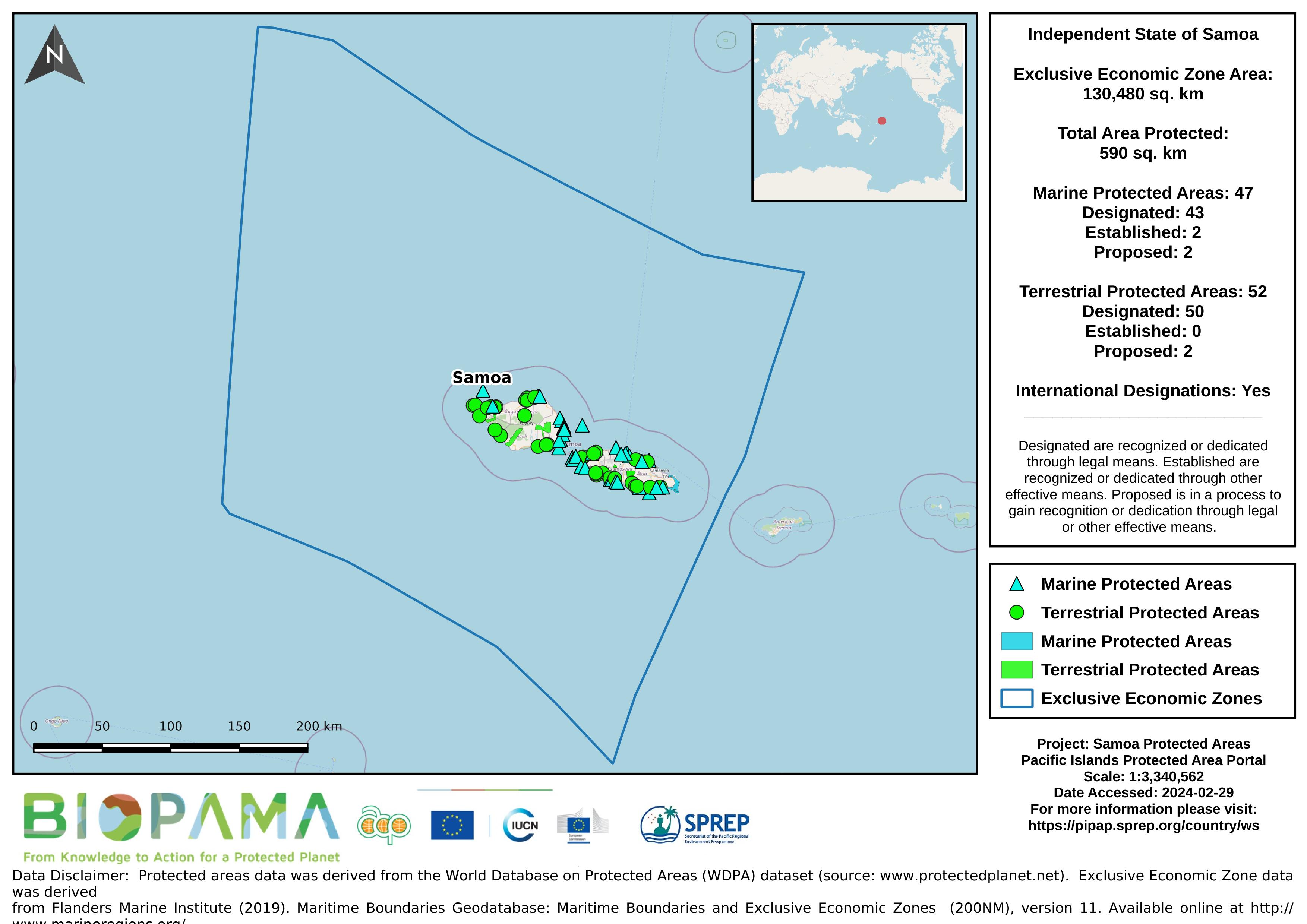
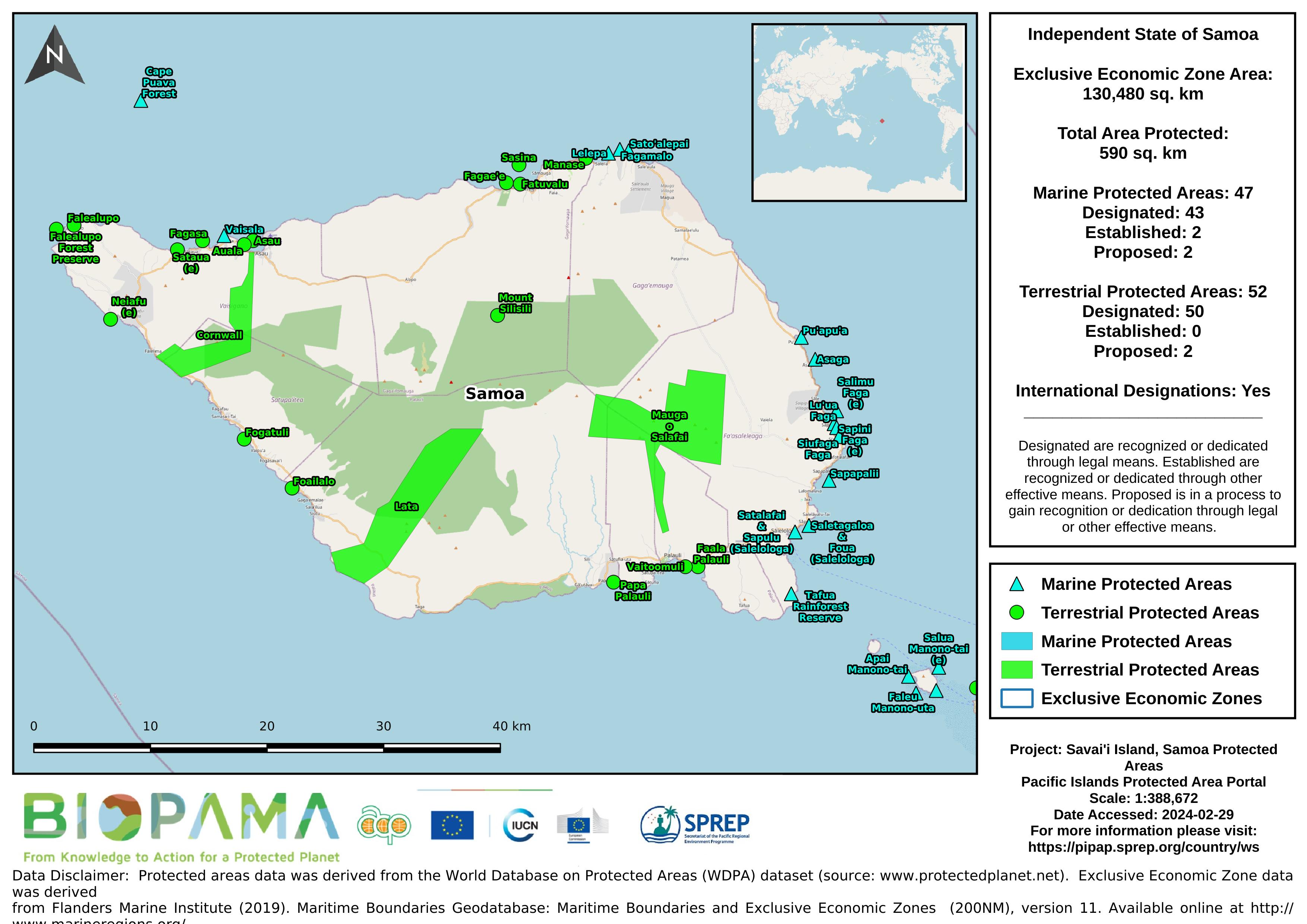
Map of the protected areas for Samoa with country-level summary statistics on the amount of area under protection, count for each type of protected area (terrestrial or marine), and the count of their designation.
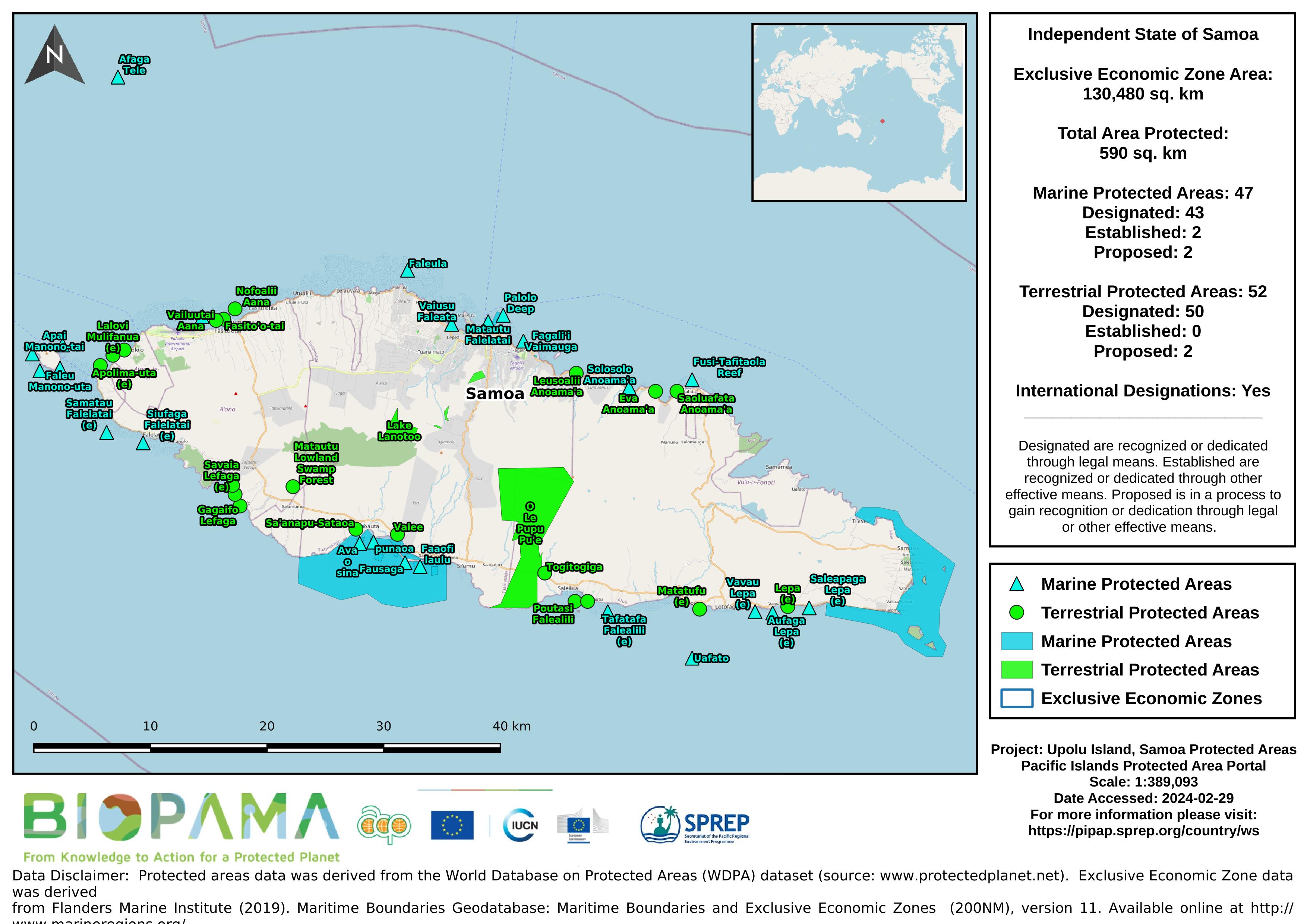
Map of the protected areas for Upolu in Samoa with country-level summary statistics on the amount of area under protection, count for each type of protected area (terrestrial or marine), and the count of their designation.
CSV file containing the global distribution of hydrothermal vent fields in WGS84 coordinate system.
CSV file containing species richness values and mapping parameters for marine species (with a probability of occurrence > 0.5) derived from AquaMaps. A total of 33,512 species were used in the generation of this file.
Coordinate system is WGS84 (ESPG 4326) with coordinates expressed in longitude and latitude.
Fields in this file are:
C-Square Code: unique identifier for grid
Longitude: longitude in decimal degrees
Latitude: latitude in decimal degrees
Species Count: number of species modeled at given point